4.1 Subways
4.1.1 Japan
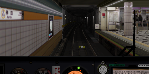
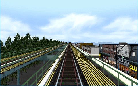
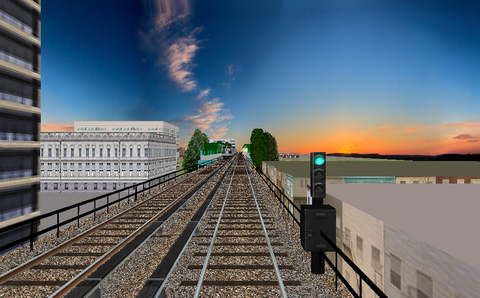
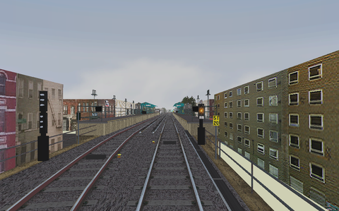
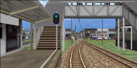
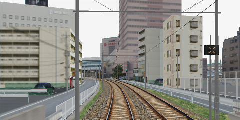
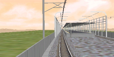
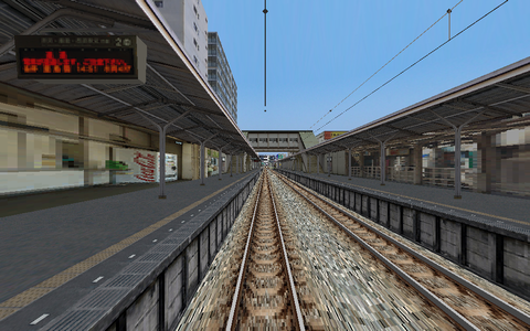
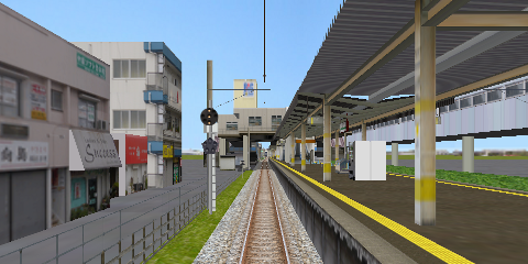
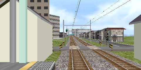
TRTA Ginza line
Description:
The
Ginza line in Tokyo's subway, for the class 01 subway train. The line goes from
Shibuya/G01 to
Asakusa/G19. The A1649 alternative that begins at G19 and goes to a lay-up track beyond station G01; the B1649 alternative goes in the opposite direction beginning at the lay-up track. There is also the B1507 alternative that begins also at the lay-up track at G01 and goes to the station
Ueno/G16, where the train is taken out of traffic and is driven to the
Ueno depot. Very well-made route with a lot of details, soft curves and realistic light conditions.
Alt.:
A1649
Stations:
19
Stops:
19
Alt.:
B1507
Stations:
17
Stops:
19
Alt.:
B1649
Stations:
19
Stops:
19
Known problems:
None
Misc.:
The following applies when driving from the
Ueno station and to the depot: On the track to the depot is a stop sign in the track (white board with a circle in black with a horizontal line through the circle). Stop by that sign and wait until a yellow light in the distance becomes lit indicating that the road crossing protection ahead is activated. In the depot yard a place to stop again is indicated before the lay-up tracks. Finally, stop the train 5
m before the end of the lay-up track, then move the train carefully forward to the indicated stop position.
From April 1 2004 (no April fools' joke) every station in the Tokyo subway has a normal station name in Japanese, but also a number. The number is composed of a western letter and two digits. The letter indicates at which line the station is, the number which station counted from one of the line's terminal stations.
The Ginza line has the letter G and the stations are numbered from 01 till 19, the terminus station Shibuya is station G01 and the other terminus Asakusa is station G19.
This number system was implemented to make it easier for foreigners to ride the subway.
Download from:
The
BVE 2 and
BVE 4 versions of this route, which are compatible with Open
BVE, have disappeared from the creator's website.
To download from this website:
OpenBVE route package ver. 1.0.0.1The code of these routes have been adapted to load without errors and warnings in OpenBVE. The graphical experience is however not changed from Green Shuttle's original work.
Last update of this directory entry:
2023-Jun-26
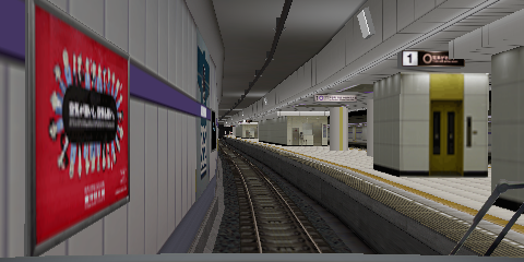
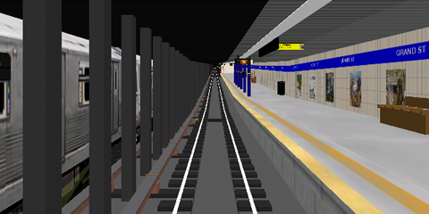
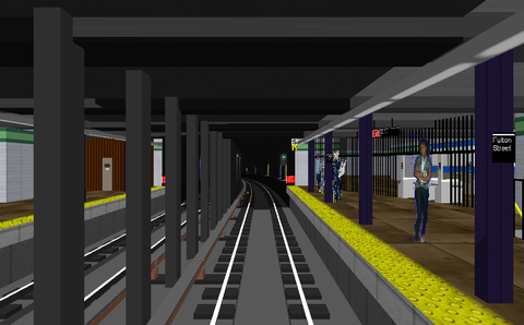
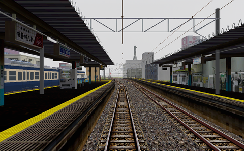
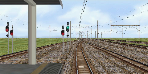
TRTA Hanzomon line
Description:
The
Hanzomon line in Tokyo's subway. The line goes from
Shibuya/Z01 to
Oshiage/Z14. For Open
BVE there is the alternative C1367S for the class 08 subway train starting at the railway station
Hikifune at the
Tobu Isesaki line then going to the subway's
Hanzomon line at which it then continues as train B1367S from
Oshiage/Z14 to
Shibuya/Z01.
Very well-made line with many details, soft curves and realistic light conditions.
Alt.:
C1367S+B1367S
Stations:
15
Stops:
14
Known problems:
In the beginning of the tunnel between
Hikifune and
Oshiage is a problem with transparency in the graphics that does not work properly. Openings in the wall to the left of the track are shown as blue.
It can be fixed by replacing the file entlight_a.bmp
in the directory Railway\Route\hanzomon\enshin\abtob
with a corrected version of entlight_a.bmp
Misc.:
The following applies when driving this route in Open
BVE: In the beginning of alternative C1367S, before departure from the railway station
Hikifune at the
Tobu Isesaki line, the safety system should be activated with the
8 key so that the indicator light
TOB
is lit. Also, the train's destination sign at the
MFD should be set with the
Page Down key to an alternative with 4 green characters in a green frame. When the train has stopped by the platform at next station,
Oshiage/Z14 at the subway's
Hanzomon line to continue as B1367S, the train's brakes should be set in the emergency brake position and the reverser in neutral position, the safety system should be changed with the
7 key so that the indicator light
TRTA
is lit, and the train's destination sign at the
MFD should be set to an alternative with 2 red characters in a red frame.
From April 1 2004 (no April fools' joke) every station in the Tokyo subway has a normal station name in Japanese, but also a number. The number is composed of a western letter and two digits. The letter indicates at which line the station is, the number which station counted from one of the line's terminal stations.
Hanzomon line has the letter Z and the stations are numbered from 01 till 14, the terminus station Shibuya is station Z01 and the other terminus Oshiage is station Z14.
This number system was implemented to make it easier for foreigners to ride the subway.
Download from:
The
BVE 4 version of this route, which is compatible with Open
BVE, has disappeared from the creator's website.
Last update of this directory entry:
2018-May-20
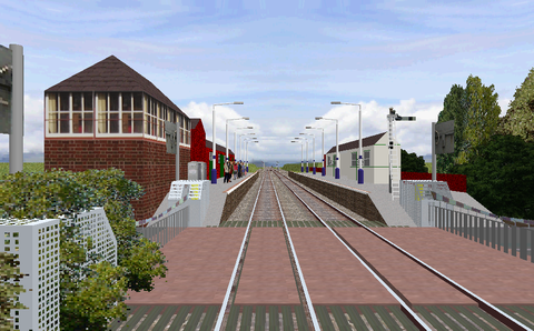
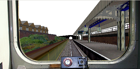
4.1.2 Great Britain
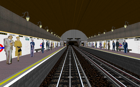
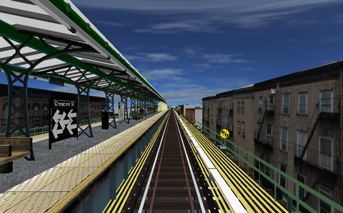
LUL East London line
Description:
A simulation of the
LUL East London line from Shoreditch to New Cross Gate. This simulation is from the year of 2002. At that time this was a line within the London subway network. The years 2007-2010 the line was extended and rebuilt to a commuter train line.
Alt.:
Normal
Stations:
8
Stops:
7
Alt.:
Rear start
Stations:
8
Stops:
7
Known problems:
There are a few transparency issues in Open
BVE with graphic objects in this route.
Line description:
About the East London line at
Wikipedia
Download from:
BEWARE! The website
www.trainsimstuff.org that claims to host this route is hijacked and redirects to another site that tries to fool people to install unknown software on their computers.
Last update of this directory entry:
2018-Jun-19
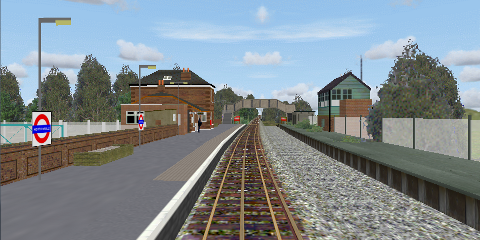
LU Central Line, Epping--Ongar
Description:
LU Central Line, the Epping--Ongar branch. This rural part of London's subway network was closed for traffic in 1994. Well-made route with many details.
Alt.:
Epping-Ongar
Stations:
4
Stops:
2
Known problems:
Download from:
The hosting website
London Underground OpenBVE / BVE 4 archive page
has disappeared from the Internet.
To download from this website:
N/A for the moment. Request to host the route sent to the creator.
Last update of this directory entry:
2023-Jun-27
4.1.3 Republic of China (a.k.a. Taiwan)
TRTC Nankang line
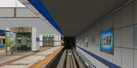
Description:
The
Nankang line in the
Taipei subway, for the class C341 subway train. The line goes between the stations
Kunyang and
Ximen. The line is a normal gauge 1435
mm line and the train power is distributed via
3rd rail 750
V DC. The
Nankang line is, as all of the
Taipei subway, rather new. This line was opened for traffic at
X-mas evening 1999, except for the part between
Kunyang and
Taipei City Hall that was opened for traffic December 30 2000. Very well-made line with many details, soft curves and realistic switches.
Alt.:
Normal
Stations:
11
Stops:
10
Known problems:
None
Misc.:
The route works with Open
BVE (but the class C341 train for the route does
not).
Download from:
The line is no longer available from the creator's web site, which has disappeared from the Internet almost 20 years ago.
Last update of this directory entry:
2023-Jun-04
TRTC Xiaobitan line
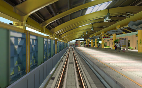
Description:
The
TRTC Xiaobitan branch line in the
Taipei subway for the class C371 subway train. The train starts from a lay-up track and then goes in revenue service from
Qizhang to
Xiaobitan. Beautiful simulation with a detailed route of the highest class.
Alt.:
Down
Stations:
2
Stops:
2
Known problems:
Download from:
The line is no longer available from the creator's web site, which has disappeared from the Internet almost 20 years ago.
To download from this website:
OpenBVE route package ver. 1.0.0.0The code of this route has been adapted to load without errors and warnings in Open
BVE. The graphical experience is however not changed from BVETRT's original work.
Last update of this directory entry:
2023-Jul-08
TRTC Zhonghe line
Description:
The
TRTC Zhonghe line in the
Taipei subway for the class C301 subway train. The line starts at the
Guting station and then goes to
Nanshijiao. Beautiful simulation with a detailed route of the highest class.
Alt.:
Down
Stations:
5
Stops:
4
Known problems:
Misc.:
The route works with Open
BVE (but the class C301 train for the route does
not).
Download from:
The line is no longer available from the creator's web site, which has disappeared from the Internet almost 20 years ago.
Last update of this directory entry:
2023-Jun-04
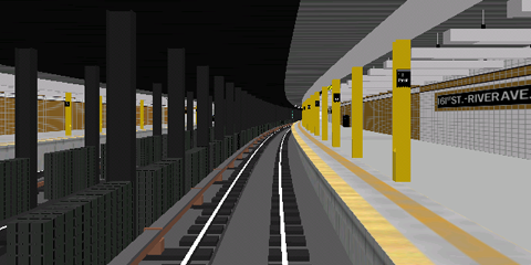
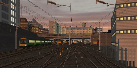
4.1.4 New York
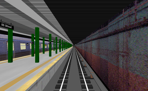
NYCTA line 1
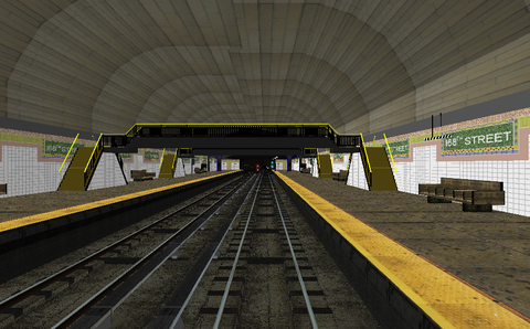
Description:
Line 1 in New York's subway (the West side line, former
IRT). The line begins at South Ferry at Manhattan and goes to Van Cortlandt/
242nd Street in the Bronx. Mix of detailed and less detailed stations, some curves are soft and some switches are realistic. No landscape details besides the elevated northern part of the line.
Alt.:
Local
Stations:
38
Stops:
36
Known problems:
To download from this website:
N/A
Last update of this directory entry:
2018-Jun-02
NYCTA line 2
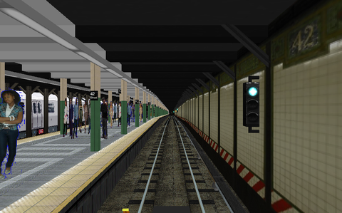
Description:
Line 2 in New York's subway (the Brooklyn line with the Flatbush branch line, part of the West Side line with the Brooklyn branch line, and finally the White Plains line, all former
IRT), for the subway train class R-142 or class R-36
Redbird
. The line begins at Flatbush Avenue/Brooklyn College in Brooklyn and goes through, among other stations, Times Square/42nd Street on Manhattan,
where this simulation ends, to Wakefield/241st Street in Bronx. Detailed stations. Plenty of trackside signs and signals (with correct signal numbers). Soft curves and realistic switches, and also announcements of all stations and connections.
Alt.:
42nd Street
Stations:
30
Stops:
22
Known problems:
In Open
BVE there are problems with transparency in the graphics that don't work. It shows as blue lines around the destination signs on the class R-62 trains that appear along the line.
The problems can be fixed by changing in the definition files for those graphic objects. In the directory LegacyContent\Railway\Object\WestsideA\cars
are the files r62_1.b3d
, r62_3.b3d
, r62_4.b3d
, r62_5.b3d
, r62_7.b3d
and r62_9.b3d
.
In each of these files the word Transparent followed by three numbers appears at 6 lines. Change in each of these files so the 4 first appearances of the Transparent-instructions are Transparent 0, 0, 255 and the 2 last are Transparent 255, 0, 0.
Misc.:
The timetable for this version of line 2 for
BVE is
not according to real life. Because of that you will be late to those stations for which times are entered in the simulation's timetable. If you keep up with the real world timetable, you will in the simulation be late to the different stations according to the table below:
| Station | Delay |
|---|
| Franklin Avenue | 2--3 min. |
| Nevins Street | 5--6 min. |
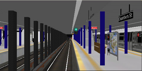
| Chambers Street | 9--11 min. |
| 14th Street | 9--12 min. |
| Times Square/42nd Street | 9--13 min. |
To download from this website:
N/A
Last update of this directory entry:
2018-Jun-02
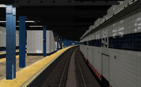
NYCTA line 6
Description:
Line 6 in New York's subway (the Pelham line and the East side line, both former
IRT), for the class R-142A subway trains. This line begins at Pelham Bay Park in the Bronx and goes to Manhattan and ends at the Brooklyn Bridge station. Then the empty train goes through the abandoned City Hall loop station and arrives at the northbound track at the Brooklyn Bridge station. The team behind this route provides a well-done and beautiful simulation of the highest class. Stations, trackside objects and the urban environment are detailed. Soft curves and realistic switches, announcement of stations and connections.
Creator:
Mr Railfan
jayjay85
Phantom909
Dj Hammers
BStyles
Alt.:
Express
Stations:
39
Stops:
29
Alt.:
Local
Stations:
39
Stops:
38
Alt.:
Parkch. Local
Stations:
33
Stops:
33
Known problems:
To download from this website:
N/A
Last update of this directory entry:
2018-Jun-15
NYCTA line 7
Description:
Line 7 in New York's subway (the Flushing line, former
IRT), for the class R36
Redbird
subway train (local) or class R62 subway train (express). The line begins with a few stations below surface on Manhattan, but most of the line is elevated going through Queens. Announcements for all stations and connecting lines.
Alt.:
7 Express
Stations:
21
Stops:
10
Alt.:
7 Local
Stations:
21
Stops:
20
Known problems:
A number of graphic objects (tunnel walls and tracks) are not properly placed or aligned, especially noticeable at the final station Main Street in the local alternative of the route.
It can be fixed by editing the route definition file
NYCT-7Local.csv
:
Move wall to the left from the 3rd rail
Original:
12175,.freeobj 0;159;1.75;0.0;3.1,.wall 1;-1;1,.wall 0;1;1,.curve -225;0,.back 1,.freeobj 3;21;-0.5;0;0,.freeobj 0;21;-0.5;0;0,.railtype 0;8,.railtype 1;9,.railtype 3;9,.ground 1,
12200,.curve 0;0,.freeobj 3;21;-0.5;0;0,.freeobj 0;21;-0.5;0;0,
12225,.freeobj 3;21;-0.5;0;0,.freeobj 0;21;-0.5;0;0,.railtype 1;8,.railtype 3;2,.railtype 0;2,.signal 3;;1.65;3.5,
Corrected:
12175,.freeobj 0;159;1.75;0.0;3.1,.wall 1;-1;1,.wall 0;1;1,.curve -225;0,.back 1,.freeobj 3;21;-0.5;0;0,.freeobj 0;21;-0.65;0;0,.railtype 0;8,.railtype 1;9,.railtype 3;9,.ground 1,
12200,.curve 0;0,.freeobj 3;21;-0.5;0;0,.freeobj 0;21;-0.65;0;0,
12225,.freeobj 3;21;-0.5;0;0,.freeobj 0;21;-0.65;0;0,.railtype 1;8,.railtype 3;2,.railtype 0;2,.signal 3;;1.65;3.5,
Remove wall section standing across track, properly align parallel track on the left
Original:
12250,.railend 5;-4.000000;0.000000;0,.railstart 7;0.000000;0.000000;9,.railtype 7;9,.wallend 0,.wall 7;1;1,.curve -120;0,.freeobj 1;21;3.5;0;0,.freeobj 0;21;-0.5;0;0,
12275,.railtype 1;8,.railtype 3;8,.railtype 0;2,.rail 3;-2.000000;0.000000;8,.rail 1;-6.000000;0.000000;8,.rail 7;2.000000;0.000000;9,.curve 120;0,.freeobj 1;21;3.5;0;0,
Corrected:
12250,.railend 5;-4.000000;0.000000;0,.railstart 7;0.000000;0.000000;9,.railtype 7;9,.wallend 0,.wall 7;1;1,.curve -120;0,.freeobj 1;21;3.5;0;0,.freeobj 6;21;-0.5;0;0,.railend 3;-4.000000;0.000000;8,.railstart 6;-4.010000;0.000000;8,
12275,.railtype 1;8,.railstart 3;-2.000000;0.000000;8,.railtype 0;2,.rail 1;-6.000000;0.000000;8,.rail 7;2.000000;0.000000;9,.curve 120;0,.freeobj 1;21;3.5;0;0,.railend 6;-2.040000;0.000000;8,
Move wall to the left to avoid gap in the wall, add missing 3rd rail
Original:
12300,.railend 3;0.000000;0.000000;8,.rail 1;-4.000000;0.000000;8,.rail 7;4.000000;0.000000;9,.curve 0;0,.freeobj 1;21;3.5;0;0,.freeobj 7;21;-0.5;0;0,.pitch 0,
12325,.freeobj 1;21;3.5;0;0,.freeobj 7;21;-0.5;0;0,
12350,.railstart 2;0.000000;0.000000;0,.railtype 2;2,.freeobj 1;21;3.5;0;0,.signal
5;;2.10;3.5,
Corrected:
12300,.railend 3;0.000000;0.000000;8,.rail 1;-4.000000;0.000000;8,.rail 7;4.000000;0.000000;9,.curve 0;0,.freeobj 1;21;3.4;0;0,.freeobj 7;21;-0.5;0;0,.pitch 0,.railtype 0;8,
12325,.freeobj 1;21;3.4;0;0,.freeobj 7;21;-0.5;0;0,
12350,.railstart 2;0.000000;0.000000;0,.railtype 2;2,.freeobj 1;21;3.4;0;0,.signal
5;;2.10;3.5,
Move wall at platform edge to the left
Original:
12499,.freeobj 7;170;-1.0;0;0,.freeobj 0;170;-1.0;0;0,
Corrected:
12499,.freeobj 7;170;-1.0;0;0,.freeobj 0;170;-1.5;0;-30,
For the express alternative of the route, only the following change may be needed in the route definition file
NYCT-7EXP.csv
:
Move wall at platform edge to the left
Original:
12499,.freeobj 7;170;-1.0;0;0,.freeobj 0;170;-1.0;0;0,
Corrected:
12499,.freeobj 7;170;-1.0;0;0,.freeobj 0;170;-1.5;0;-30,
To download from this website:
Route files with the changes mentioned in the
Known problems
section above done.
Last update of this directory entry:
2018-Jun-02
NYCTA line A
Description:
Line A in New York's subway (
8th Avenue line and Fulton Street line, both former
IND), for the class R46 subway trains. The simulated alternative of the A-line starts at
207th Street far north at Manhattan and ends in Ozone Park/Lefferts Boulevard in Queens. Included is also a simulation of the Lefferts Boulevard Shuttle. The shuttle line starts at Euclid Avenue in Brooklyn and goes to Ozone Park/Lefferts Boulevard in Queens. This shuttle line is only operated at night. During daytime ordinary A-line trains serve that part of the line. Detailed line, both stations and trackside! Soft curves and realistic switches, announcement of all stations and connections.
Alt.:
A daytime
Stations:
52
Stops:
29
Alt.:
Lefferts
Blvd Shuttle
Stations:
8
Stops:
7
Known problems:
To download from this website:
N/A
Last update of this directory entry:
2018-Jun-02
NYCTA line B
Description:
Line B in New York's subway (part of the 6th Avenue line, part of the Queens Boulevard line, part of the 8th Avenue line and Concourse line, all former
IND), for the class R-68 subway train. This line is entirely under surface and this rush hour alternative begins at Bedford Park Boulevard in the Bronx (ordinary hours the line starts at
145th Street at Manhattan), and goes to Grand Street at Manhattan,
where this simulation ends. In the real world the line continues to Brighton Beach in Brooklyn. Detailed line, both stations and trackside. Soft curves and realistic switches, announcement of all stations and connections.
Alt.:
Rush hour
Stations:
28
Stops:
27
Known problems:
This line uses graphical objects from the
NYCTA A,
NYCTA C, and
NYCTA D lines, which must be installed before this line can be used.
The graphic object for a trailing switch at the exit of 59th Street/Columbus Circle shows the switch in the wrong position.
Download from:
The route has disappeared from the website
BVEstation
Last update of this directory entry:
2018-Jun-06
NYCTA line B
Description:
Line B in New York's subway (part of the 6th Avenue line, part of the Queens Boulevard line, part of the 8th Avenue line and Concourse line, all former
IND), for the classes R-68 or R-160A subway trains. This line goes from Wakefield-
241st Street in the Bronx and goes through Manhattan to Brighton Beach in Brooklyn. There is also an alternative from
145th Street on Manhattan to Euclid Avenue in Brooklyn. The team behind this route provides a well-done and beautiful simulation of the high class. Stations, trackside objects and the urban environment is detailed. Soft curves and realistic switches, announcement of stations and connections.
Creator:
Mr Railfan
jayjay85
Phantom909
BVEstation staff
Alt.:
145-E.A. (NTT)
Stations:
37
Stops:
37
Alt.:
205-BB (NTT)
Stations:
48
Stops:
30
Alt.:
205-BB (SMEE)
Stations:
48
Stops:
30
Known problems:
There are more objects to download for this line than is mentioned on the route's download page. This route uses the "IND Valley Stream" object pack. It cannot be separately downloaded but is included with the newest version of F line. The LefShut
object pack is also needed. It cannot be separately downloaded but is included with the A line. All archives listed in the "Download from"-section below and are needed to get this route to display the graphics properly.
To download from this website:
N/A
Last update of this directory entry:
2018-Jun-15
NYCTA line C
Description:
Line C in New York's subway (
8th Avenue line and Fulton Street line, both former
IND), for the class R32
Brightliner
subway trains. The simulated line starts at a track in the
174th Street Depot at northern Manhattan, from which the train goes to the
168th Street station at Manhattan to start revenue service. Revenue service ends at the Euclid Avenue station in Brooklyn, from which the train is moved off service to a track towards Pitkin Avenue Depot to change direction. Detailed line, both stations and trackside! Soft curves and realistic switches, announcement of all stations and connections.
Alt.:
Normal
Stations:
40
Stops:
41
Known problems:
A facing switch at the exit from station
59th Street/Columbus Circle looks like it leads to the diverting track, but the train is going on the straight track. That can be fixed by editing the route definition file
NYCT-C.rw
changing the graphic object representing the switch:
At line 20800 there is a lot of code. Change the original file's @freeobj(0,1413,0,0,0)
to
@freeobj(0,1407,0,0,0) and then save the altered file and you are done.
Misc.:
This simulation requires the
NYCTA line A to be installed as it uses graphic objects from this line simulation.
To download from this website:
N/A
Last update of this directory entry:
2018-Jun-05
NYCTA line C
Description:
Line C in New York's subway (
8th Avenue line and Fulton Street line, both former
IND). The simulated line starts at a track in the
174th Street Depot at northern Manhattan, from which the train goes to the
168th Street station at Manhattan to start revenue service. Revenue service ends at the Euclid Avenue station in Brooklyn, from which the train is moved off service to a track towards Pitkin Avenue Depot to change direction. Detailed line, both stations and trackside! Soft curves and realistic switches, announcement of all stations and connections.
Creator:
The NYCTBA Team
Mr Railfan
jayjay85
Phantom909
BVEstation staff
Alt.:
10 cars
NTT
Stations:
40
Stops:
40
Alt.:
10 cars SMEE
Stations:
40
Stops:
40
Alt.:
8 cars
NTT
Stations:
40
Stops:
40
Alt.:
8 cars SMEE
Stations:
40
Stops:
40
Known problems:
A facing switch at the exit from station
59th Street/Columbus Circle looks like it leads to the diverting track, but the train is going on the straight track. That can be fixed by editing the route definition file
NYCT-C.rw
changing the graphic object representing the switch:
At line 20800 there is a lot of code. Change the original file's @freeobj(0,1413,0,0,0)
to
@freeobj(0,1407,0,0,0) and then save the altered file and you are done.
Misc.:
This simulation requires the
NYCTA line C by
The NYCTBA Team
to be installed as it uses graphic objects from this line simulation. This simulation is an update of the NYCTBA Team's simulation, mainly changing all signals to the proper
NYC subway style of light signals.
Download from:
Comes bundled with
NYCTA line B by
jayjay85
and others.
To download from this website:
N/A
Last update of this directory entry:
2018-Jun-08
NYCTA line C
Description:
Line C in New York's subway (
8th Avenue line and Fulton Street line, both former
IND), for the class R-160A subway trains. The simulated line starts at a track in the
174th Street Depot at northern Manhattan, from which the train goes to the
168th Street station at Manhattan to start revenue service. Revenue service ends at the Euclid Avenue station in Brooklyn, from which the train is moved off service to a track towards Pitkin Avenue Depot to change direction. Detailed line, both stations and trackside! Soft curves and realistic switches, announcement of all stations and connections.
Known problems:
There are more objects to download for this line than is mentioned on the route's download page. This route uses the
6thAve
and
LisaRaye2
object packs. The route also uses the object directory
LefShut
. It cannot be separately downloaded but is included with the A line. All archives listed in the "Download from"-section below and are needed to get this route to display the graphics properly.
However, there are also needs for objects that are not present in the object directory 6thAve
even if it is downloaded. Also in the object directories included with the route, 8thAve
and ind 8th avenue
, there are objects missing.
Unfortunately, there are a lot of graphic errors in this route when using it with the most recent version of OpenBVE:
- Almost all signals along the line are missing.
-
A facing switch at the exit from station 59th Street/Columbus Circle looks like it leads to the diverting track, but the train is going on the straight track. That can be fixed by editing the route definition file, changing the graphic object representing the switch:
At line 20800 there is a lot of code. Change the original file's
@freeobj(0,1413,0,0,0)
to
@freeobj(0,1407,0,0,0) and then save the altered file and you are done.
- At the exit of the station Canal Street a cross-over with four switches is broken.
- At the exit of the station Hoyt-Schermerhorn Streets a cross-over with four switches is broken.
- At the exit of the station Euclid Avenue three switches are broken.
- At the lay-up track beyond the station Euclid Avenue a cross-over with four switches is totally missing.
Misc.:
This simulation seems to be an update of an update of The NYCTBA Team's simulation, mainly changing a lot of textures to give a better look.
To download from this website:
N/A
Last update of this directory entry:
2018-Jun-08
NYCTA line D
Description:
Line D in New York's subway (part of the 6th Avenue linen, part of the Queens Boulevard line, part of the 8th Avenue line and the Concourse line, all former
IND), for the class R-68 subway train. This line is entirely under the surface and begins at a layup track at Norwood/
205th Street in the Bronx and goes to Grand Street at Manhattan,
where this simulation ends. In the real world, the line continues to Coney Island in Brooklyn. Detailed line, both stations and trackside! Soft curves and realistic switches, announcement of all stations and connections.
Alt.:
D
Stations:
29
Stops:
21
Known problems:
Misc.:
This line uses graphical objects from the
NYCTA A line, which must be installed before this line can be used.
Download from:
This line has disappeared from the website
BVEstation.
Last update of this directory entry:
2018-Jun-05
NYCTA line D
Description:
Line D in New York's subway (part of the 6th Avenue line, part of the Queens Boulevard line, part of the 8th Avenue line and the Concourse line, all former IND), for the classes R-68 or R- 160 subway trains. This line begins at a layup track at Norwood/205th Street in the Bronx and goes to via Manhattan to Coney Island in Brooklyn. The team behind this route provides a well-done and beautiful simulation of the highest class. Stations, trackside objects and the urban environment are detailed. Soft curves and realistic switches, announcement of stations and connections.
Creator:
Mr Railfan
jayjay85
Phantom909
Dj Hammers
Alt.:
205st-Bay50st
Stations:
50
Stops:
35
Alt.:
205st-C.I.
Stations:
51
Stops:
36
Alt.:
205st-C.I. ConX
Stations:
51
Stops:
30
Alt.:
205st-C.I. W.E.X
Stations:
51
Stops:
29
Known problems:
There are more objects to download for this line than is mentioned on the route's download page. This route uses the IND Valley Stream
object pack. It cannot be separately downloaded but is included with the newest version of F line. Both archives are listed in the "Download from"-section below and are needed to get this route to display the graphics properly
To download from this website:
N/A
Last update of this directory entry:
2018-Jun-15
NYCTA line E
Description:
Line E from the year of 2007 in New York's subway (the Queens Boulevard line and a part of the 8th Avenue line, both former
IND), for the class R32
Brightliner
subway trains. All of this line is below surface, from Jamaica Center to Chambers Street/
WTC. Signals, trackside signs and different types of stations. Announcements of stations and connections for other lines.
Alt.:
Towards Manhattan
Stations:
28
Stops:
19
Known problems:
An error exists in the route definition file
NYCT-E.csv
. One line in the route definition file should be edited as follows:
Original:
.folder r32;R32 Train (Brightliner),
Corrected:
.folder r32,
Two files need to be copied from the directory
LegacyContent\Railway\Object\UchiboX
to the directory
LegacyContent\Railway\Object
:
To download from this website:
Missing object files from the
Uchibo line (see the section
Known problems
above)
Last update of this directory entry:
2018-Jun-09
NYCTA line F
Description:
Line F in New York's subway (the Culver line, Part of the Brooklyn/Queens Crosstown line, the 6th Avenue line, and a part of the Queens Boulevard line, all except for the Culver line former
IND, the Culver line former
BMT), for the class R-46 subway train. The line goes from Coney Island in Brooklyn via Manhattan to Jamaica -
179th Street in Queens. There are no less than 36 alternatives (!) to drive the whole or parts of the line. The alternative data below is for an average alternative all the way.
Alt.:
Average
Stations:
51
Stops:
45
Known problems:
There are more objects to download for this line than are included in the route's archive file. All archives listed in the "Download from"-section below are needed to get this route to display the graphics properly.
There is also an object package NYCTCommon
that is neither included nor available as separate download. It is however included in the V line package. Download and install the V line also to get it.
To download from this website:
N/A
Last update of this directory entry:
2018-Jun-05
NYCTA line G
Description:
Line G in New York's subway (part of the Brooklyn/Queens Crosstown line plus a part of the Queens Boulevard line, both former
IND) for the class R46 subway train. The line starts at the station Court Square in Queens and goes to Smith/9th Street in Brooklyn (without ever going to Manhattan). Detailed line, both stations and trackside. Soft curves and realistic switches, announcement of all stations and connections.
Alt.:
Express
Stations:
16
Stops:
9
Alt.:
Local
Stations:
16
Stops:
15
Known problems:
There are more objects to download for this line than are included in the route's archive file. All archives listed in the "Download from"-section below are needed to get this route to display the graphics properly. The object directory LefShut
comes with the A line which also needs to be downloaded.
To download from this website:
N/A
Last update of this directory entry:
2018-Jun-06
NYCTA line J
Description:
Line J in New York's subway (a small part of the Queens Boulevard Line, former
IND, the Jamaica line, then via the Williamsburg bridge to Manhattan and the Nassau Street line, those later all former
BMT). This J line simulation begins at a lay-up track beyond Jamaica Center - Parsons/Archer in Queens, starts revenue service at that station, and goes via Brooklyn to Broad Street at lower Manhattan. Then the train is moved, out of revenue service, to a layup track beyond the last station. The team behind this route provides a well-done and beautiful simulation of the highest class. Stations, trackside objects and the urban environment is detailed. Soft curves and realistic switches, announcement of stations and connections. Different alternatives for the whole or parts of the line at various times of day.
Creator:
Mr Railfan
jayjay85
Phantom909
Dj Hammers
Alt.:
Midday A
Stations:
30
Stops:
27
Alt.:
Midday B
Stations:
30
Stops:
28
Alt.:
Rush
hrs. express A
Stations:
30
Stops:
20
Alt.:
Rush
hrs. express B
Stations:
30
Stops:
21
Known problems:
There are more objects to download for this line than is mentioned on the route's download page. This route uses four object packs that are not included in the route's archive file. All archives are listed in the "Download from"-section below and are needed to get this route to display the graphics properly.
To download from this website:
N/A
Last update of this directory entry:
2018-Jun-15
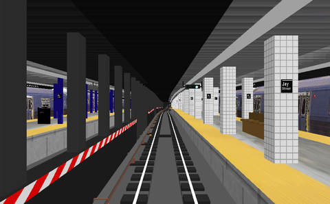
NYCTA line L
Description:
Line L in New York's subway (Canarsie line, former
BMT), for the class R-143 subway train. The line goes from Rockaway Parkway in Brooklyn to
8th Avenue on Manhattan. Announcements of stations and connecting lines. Nice landscape details outdoors. The creators of the line have made an effort to get the signal aspects to look like they do in real life. Few trackside details and details at stations.
Alt.:
Towards Manhattan
Stations:
24
Stops:
23
Known problems:
This line uses graphical objects from the
NYCTA E line, which must be installed before this line can be used.
The graphic objects for class R-143 trains are not shown properly.
To download from this website:
N/A
Last update of this directory entry:
2018-Jun-15
NYCTA line L
Description:
Line L in New York's subway (Canarsie line, former
BMT), for the class R-143 subway train. The line goes from Rockaway Parkway in Brooklyn to
8th Avenue on Manhattan. Announcements of stations and connecting lines. Nice landscape details outdoors. The creators of the line have made an effort to get the signals and signal aspects to look like they do in real life. Few details at stations.
Alt.:
To Bedford
Av.
Stations:
24
Stops:
23
Alt.:
Evening
Stations:
24
Stops:
23
Alt.:
To Lorimer
St.
Stations:
24
Stops:
23
Alt.:
Night
Stations:
24
Stops:
23
Alt.:
Rush hour
Stations:
24
Stops:
23
Known problems:
The timetables show the same departure and arrival time for all route alternatives, not considering the time of day stated.
The 2 evening alternatives to Bedford Avenue and Lorimer Street actually go to 8th Avenue as the 3 other alternatives.
Misc.:
This is an update of the
NYCTA L line. The main updates are a change of a lot of textures and that the light signals have been changed to look like real
NYC subway light signals.
To download from this website:
N/A
Last update of this directory entry:
2018-Jun-09
NYCTA line M
Description:
Line M in New York's subway (the remaining part of the Myrtle Avenue line, part of the Jamaica line, then via the Williamsburg bridge to Manhattan and the Nassau Street line, all former
BMT). The M line begins at Middle Village - Astoria Avenue in Queens and goes via Brooklyn to Broad Street in lower Manhattan. Then the train is moved, out of revenue service, to a layup track beyond the last station. The team behind this route provides a well-done and beautiful simulation of the highest class. Stations, trackside objects and the urban environment is detailed. Soft curves and realistic switches, announcement of stations and connections. Different alternatives for the whole or parts of the line at various times of day.
Creator:
Mr Railfan
jayjay85
Phantom909
Dj Hammers
Alt.:
To Chambers
St.
Stations:
16
Stops:
15
Alt.:
To Essex
St.
Stations:
13
Stops:
12
Alt.:
Express
Stations:
18
Stops:
15
Alt.:
Local
Stations:
18
Stops:
18
Alt.:
Shuttle to
M.A.
Stations:
8
Stops:
7
Known problems:
Download from:
This line comes in a bundle with the J line and the Z line. For downloads, se the
J line.
To download from this website:
N/A
Last update of this directory entry:
2018-Jun-15
NYCTA line N
Description:
Line N in New York's subway (the Astoria line, part of the Broadway line part of the
4th Avenue line, Manhattan Bridge and the Sea Beach line, all former
BMT).
The line starts at Astoria/Ditmars Boulevard in Queens and goes via Manhattan to Bay
50th Street in Brooklyn. There are no less than 27 (!) alternatives for this line. The creators of this route have made a simulation of very high class. A lot of details trackside and in the urban environment, soft curves and realistic switches.
Creator:
Mr Railfan
jayjay85
Phantom909
BVEstation staff
Known problems:
A few switches are shown in another position than the train goes.
Misc.:
With this route are also bundled a few line M and line W alternatives, and also a
garbage train's route through the subway system.
To download from this website:
N/A
Last update of this directory entry:
2018-Jun-10
NYCTA line Q
Description:
Line Q in New York's subway (Brighton line, Manhattan Bridge, Broadway line,
60th Street tunnel and Astoria line; all former
BMT) for the various classes of subway trains. The Q line begins at Astoria-Ditmars Boulevard in Queens, goes to Manhattan and then to Brighton Beach in Brooklyn. The team behind this route provides a well-done and beautiful simulation of the highest class. Stations, trackside objects and the urban environment is detailed. Soft curves and realistic switches, announcement of stations and connections. No less than 25 alternatives for the whole or parts of the line with various train classes and time of day.
Creator:
Mr Railfan
jayjay85
Phantom909
BVEstation staff
Known problems:
There are more objects to download for this line than is mentioned on the route's download page. All archives listed in the Download from
-section below are needed to get this route to display the graphics properly.
The graphic object for facing switches at 57th Street, 34th Street, and some 700 m before DeKalb Avenue shows the switch in the wrong position. A trailing switch 375 m beyond DeKalb Avenue is also shown in the wrong position.
Misc.:
The directory names of the directories to which a certain train class installs are not always the same as the directory name expected in the Q-line route definitions. Then manual selection of train is needed in Open
BVE. The corresponding train directories' names are as follows:
| Train dir. in route | Use train dir. |
|---|
| R68 | R68 2017 |
| R160 | R160 Alstom - 10 car |
| R160A | R160 Alstom - 10 car |
| R160 Siemens OpenBVE | R160 Siemens OpenBVE |
| BMT Standard | R1*) |
*) = Any
BMT Standard
train is not available for Open
BVE. The R1 is a replacement to get an old subway train for the fan trip route alternative.
To download from this website:
N/A
Last update of this directory entry:
2018-Jun-15
NYCTA line R shuttle
Description:
A shuttle line that is a part of line R in New York's subway (the 4th Avenue line former
BMT), for the class R-46 subway train. This shuttle part of line R starts at Bay Ridge/
95th Street in Brooklyn and goes to the station at
36th Street in Brooklyn and a reverse track beyond that station. Trackside details, realistic signal aspects, soft curves and realistic switches.
Alt.:
Northbound
Stations:
8
Stops:
6
Known problems:
To download from this website:
N/A
Last update of this directory entry:
2018-Jun-14
NYCTA line R
Description:
Line R in New York's subway
(the Astoria line, the Broadway line and the 4th Avenue line, all former
BMT) for the class R-46 subway train. This line starts at Astoria - Ditmars Boulevard in Queens. It is going via Manhattan to Bay Ridge/
95th Street in Brooklyn. This is the route the R line had until May 24, 1987. The team behind this route provides a well-done and beautiful simulation of the highest class. Stations, trackside objects and the urban environment is detailed. Soft curves and realistic switches, announcement of stations and connections.
Creator:
The NYCTBA Team
Mr Railfan
jayjay85
ARome
Alt.:
R pre 1987
Stations:
39
Stops:
21
Known problems:
This route is released as a
Beta
version. A few switches are shown leading in another direction than the train actually goes.
There are more objects to download for this line than are mentioned on the route's download page. This route uses the LefShut
object directory. It cannot be separately downloaded but is included with the newest version of A line. This route also uses the 4thAve
object directory. It cannot be separately downloaded but is included with the newest version of R Shuttle line. All archives are listed in the "Download from"-section below and are needed to get this route to display the graphics properly
To download from this website:
N/A
Last update of this directory entry:
2018-Jun-15
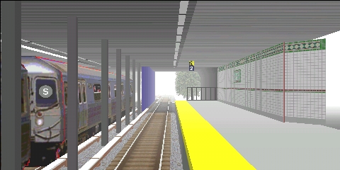
NYCTA line S - 42nd Street Shuttle
Description:
Line S -
42nd Street Shuttle (line letter S is used by all shuttle lines) in New York's subway (former
IRT), for the class R-62 subway train. This is a shuttle line on Manhattan with only 2 stations: Grand Central Shuttle Terminal and Times Square. A few trackside and station details in the simulation, announcement of station and connections. There are 2 alternatives for this line: One eastbound and one westbound.
Alt.:
Towards Grand Central
Stations:
2
Stops:
1
Alt.:
Towards Times Square
Stations:
2
Stops:
1
Known problems:
In the westbound alternative there is, beyond a clear signal, an 8 cars ghost train occupying the track at the
42nd Street station. In the eastbound alternative there are pillars and a signal right in front of the train's cab. The route definition code needs some overhaul to get this route, originally made for
BVE2, to work properly with Open
BVE.
To download from this website:
N/A
Last update of this directory entry:
2018-Jun-12
NYCTA line S - Franklin Avenue Shuttle
Description:
Line S - Franklin Avenue Shuttle (line sign S is used by all shuttle lines) in New York's subway (former
BMT).This partially single track shuttle line from Franklin Avenue to Prospect Park in Brooklyn has 4 stations. This is entirely a surface line. The lack of landscape details has in the southbound alternative been compensated by fog limiting the viewing distance.
Creator:
The NYCTBA Team
coneykidw8
Alt.:
Northbound
Stations:
4
Stops:
3
Alt.:
Southbound
Stations:
4
Stops:
3
Known problems:
To download from this website:
N/A
Last update of this directory entry:
2018-Jun-11
NYCTA line SS - Franklin Avenue Shuttle 1969
Description:
Line SS - Franklin Avenue Shuttle (line sign SS was used by all shuttle lines) in New York's subway (former
BMT). The simulation is as the line was in the year of 1969. This partially single track shuttle line from Franklin Avenue to Prospect Park in Brooklyn had at that time 5 stations. This route is of very high class with a lot of urban landscape details, soft curves and realistic signals and switches. Alternatives for this route are all southbound and based on time of day and/or weather.
Alt.:
Dawn (Clear)
Stations:
5
Stops:
4
Alt.:
Dawn (Cloudy)
Stations:
5
Stops:
4
Alt.:
Day
Stations:
5
Stops:
4
Alt.:
Sunset
Stations:
5
Stops:
4
Known problems:
To download from this website:
N/A
Last update of this directory entry:
2018-Jun-12
NYCTA line S - Grand Street Shuttle
Description:
Line S - Grand Street Shuttle (line letter S is used by all shuttle lines) in New York's subway for the class R-46 subway train. This temporary shuttle line goes between Grand Street and West 4th Street/Washington Square on Manhattan.
Alt.:
Northbound
Stations:
3
Stops:
2
Known problems:
Line description:
The real life S - Grand Street Shuttle at
Wikipedia
Misc.:
This temporary shuttle line was only operative from the summer of 2001 and until the beginning of 2004 during the Manhattan Bridge reparation works. During that time, the line had the
simulated route from the end of 2001 and later.
Download from:
The creator's web site www.nyctba.com has disappeared from the Internet long, long ago.
Last update of this directory entry:
2018-Jun-12
NYCTA line V
Description:
Line V in New York's subway (part of the 6th Avenue line, part of the Queens Boulevard linen, both former
IND). The line begins at Lower Eastside/
2nd Avenue on Manhattan and goes to Forest Hills/
71st Avenue in Queens and a reverse track beyond that station. The holiday alternative for the old R-1 train is shorter and stops at Queens Plaza in Queens. The creators of this route have made a simulation of high class. A lot of details trackside, soft curves and realistic switches.
Creator:
Phantom909
ipaclansite
coneykidw8
Alt.:
Holiday (R-1)
Stations:
12
Stops:
11
Alt.:
Local
Stations:
24
Stops:
24
Known problems:
To download from this website:
N/A
Last update of this directory entry:
2018-Jun-10
NYCTA line Z
Description:
Line Z in New York's subway (a small part of the Queens Boulevard Line, former
IND, the Jamaica line, then via the Williamsburg bridge to Manhattan and the Nassau Street line, those later all former
BMT). This Z line simulation begins at a lay-up track beyond Jamaica Center - Parsons/Archer in Queens, starts revenue service at that station, and goes via Brooklyn to Broad Street at lower Manhattan. Then the train is moved, out of revenue service, to a layup track beyond the last station. The team behind this route provides a well-done and beautiful simulation of the highest class. Stations, trackside objects and the urban environment is detailed. Soft curves and realistic switches, announcement of stations and connections. Different alternatives for the whole or parts of the line at various times of day.
Creator:
Mr Railfan
jayjay85
Phantom909
Dj Hammers
Alt.:
Express
Stations:
30
Stops:
21
Alt.:
Local
Stations:
30
Stops:
31
Alt.:
Rush
hrs. express A
Stations:
30
Stops:
20
Alt.:
Rush
hrs. express B
Stations:
30
Stops:
21
Known problems:
Download from:
This line comes in a bundle with the J line and the M line. For downloads, se the
J line
To download from this website:
N/A
Last update of this directory entry:
2018-Jun-15
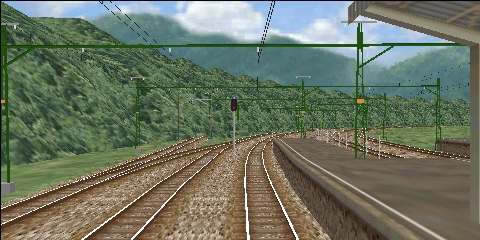
4.3 Railroads
4.3.1 Japan
Iida line
Description:
A part of the
Iida line (
JR Central)from
Nanakubo to
Okaya. An electrified line in a very beautiful landscape with mountains, rivers and canals. Many nice details in the landscape. There are 2 alternatives for this route: Express using the class 115-2000
EMU and local using the class 119
EMU.
Alt.:
Express
Stations:
25
Stops:
11
Alt.:
Local
Stations:
25
Stops:
24
Known problems:
None.
Line description:
Overview map (Acrobat document) with the
Iida line marked on the map. The simulated part of the line starts at the map south of
Komagane and goes northwards to
Okaya.
Download from:
The creator's website has disappeared from the Internet many years ago.
To download from this website:
OpenBVE route package ver. 1.0.0.2The code of this route has been adapted to load without errors and warnings in Open
BVE. The graphical experience is however not changed from Gaku's original work.
Last update of this directory entry:
2023-Jun-25
Kobe & Kyoto line
Description:
JR West Kobe line from
Kobe to
Osaka and the
JR West Kyoto line to
Kyoto for the class 223-2000
EMU. Details are sparse in the urban environment.
Alt.:
Spec. Rapid
Svc.
Stations:
29
Stops:
7
Known problems:
A track section at the Osaka station is displayed too high compared to the other rails.
Download from:
The website for this route has disappeared from the Internet long, long ago.
Last update of this directory entry:
2018-Jun-18
Kosei line
Description:
The
JR West Kosei line from
Kyoto (JR-B31) to
Omi-Maiko (JR-B19). The gauge is 1067
mm and the line is electrified with 1500
V DC overhead wires. No landscape details outside the railway.
Alt.:
1828M2 (Local)
Stations:
13
Stops:
12
Known problems:
Line description:
About the
Kosei line at
Wikipedia.
Download from:
The website for this route has disappeared from the Internet long, long ago.
Last update of this directory entry:
2018-Jun-18
Keio line
Description:
The
Keio line, the
Takao line and the
Sagamihara line (all
Keio Electric Railway
Co.,
Ltd.) for the class 8000 trains express alternative and the class 9000 trains
Rapid
alternative. The route comes in 3 versions: Semi-Special Express from
Shinjuku to
Takaosanguchi; Special Express from
Shinjuku to
Keio-hachioji;
Rapid
from
Shinjuku to
Hashimoto. The gauge is 1372
mm and the lines are electrified (1500
V DC). Many graphic objects at the railroad.
Alt.:
Rapid
Stations:
27
Stops:
20
Alt.:
Semi-Special
Exp.
Stations:
37
Stops:
11
Alt.:
Special Express
Stations:
32
Stops:
6
Known problems:
None.
Line description:
Schematic map over the Keio lines (Acrobat document) there all route alternatives start at
Shinjuku near the top of the map at the
Keio line. The Semi-Special Express alternative (orange line at the map) goes to
Kitano, from there the
Takao line and ends at the station
Takaosanguchi at the bottom of the map. The Special Express alternative (red line at the map) goes all the
Keio line and ends at
Keio-hachioji, the other station far down at the map. The Rapid alternative (blue line) goes to
Chofu and then the
Sagamihara line to the right and downwards at the map to
Hashimoto.
Keio Electric Railway's web site
Download from:
The creator's website has disappeared from the Internet.
To download from this website:
OpenBVE route package ver. 1.0.0.0
The code of this route has been adapted to load without errors and warnings in Open
BVE. The graphical experience is however not changed from Minatonos's original work.
Last update of this directory entry:
2020-Mar-05
Keisei Chiba line
Description:
Part of the
Keisei Chiba line from
Midori-dai via
Nishi-Nobuto and
Shin-Chiba to
Chiba. Detailed route in an urban environment.
Alt.:
11B17
Stations:
4
Stops:
3
Known problems:
Line description:
Download from:
Mackoy's website. Click the link
Download
at the bottom of the webpage.
To download from this website:
N/A
Last update of this directory entry:
2018-May-31
Minobu line
Description:
Part of the
Minobu line (
JR Central) for the class 115 train. The simulated alternative is a local train from
Higashi-Hanawa to
Fujinomiya. The line is electrified and goes through a beautiful landscape; the creator of this route has done a fantastic job creating the landscape!
Alt.:
Local
Stations:
25
Stops:
24
Known problems:
None.
Line description:
About the
Minobu line at
Wikipedia.
Download from:
The website for this route has disappeared from the Internet more than 10 years ago.
To download from this website:
OpenBVE route package ver. 1.0.0.1
The code of this route has been adapted to load without errors and warnings in Open
BVE. The graphical experience is however not changed from Gaku's original work.
Last update of this directory entry:
2023-Jun-25
Nanbu line
Description:
Part of the
Nanbu line, often also translated as the
Nambu line, (
JR East) from
Nakanoshima to
Hirama for the class 205 train. There are 3 alternatives for this route to select from: A daytime local train, a daytime local train in rainy weather, and an evening local train. The line's gauge is 1067
m.m. and the line is electrified (1500
V DC). Many details along the railroad and a lot of surrounding buildings.
Alt.:
Daytime
Stations:
11
Stops:
10
Alt.:
Daytime (rain)
Stations:
11
Stops:
10
Alt.:
Evening
Stations:
11
Stops:
10
Known problems:
This route uses graphic objects from the
Uchibo line which must be installed before this route can be used.
Line description:
Misc.:
The train class used for this line in real life is a class 205 version 1200
EMU with 6 cars, of which 4 motorized cars and 2 trailer cars. That train is no longer available for Open
BVE. The class 205
EMU for the
Keiyo line has similar driving properties and is used instead.
Download from:
The creator's website has disappeared from the Internet >10 years ago.
Last update of this directory entry:
2018-May-28
Nankai main line & airport line
Description:
The
Hon-line (
Nankai Electric Railway
Co.,
Ltd.) from
Namba to
Wakayamashi as
Limited Express
with the class 7100 train,
Express
with the class 1000 or class 7000 trains, or as local with class 7100 train. Also
Airport Express
from
Namba to
Kansai airport, using a part of the
Hon line and then the
Kuko line, for the class 1000 train. The gauge is 1067
mm and the lines are electrified (1500
V DC). No landscape details outside the railroad.
Alt.:
Airport Express
Stations:
32
Stops:
11
Alt.:
Express (1000)
Stations:
42
Stops:
12
Alt.:
Express (7000)
Stations:
42
Stops:
11
Alt.:
Limited Express
Stations:
42
Stops:
6
Alt.:
Local
Stations:
42
Stops:
39
Known problems:
Line description:
Line map over railroads and subway in the Osaka area (Acrobat document). For all route alternatives follow the
Hon line (main line, blue-green at the map) southwards from
Namba via
Kishinosato Tamade,
Hagoromo,
Kaizuka and then westwards to
Izumisai.
The alternatives to Wakayamashi continues at the Hon line (main line, blue-green at the map) from Izumisai southwest via Misaki-koen towards Wakayamashi.
The alternatives to Kansai airport continues at the Kuko line (airport line, blue-green at the map) straight north from Izumisai to the Kansai airport.
Stations at the Nankai railway's lines. The main line is called Hon
. Click at Map
by a station name to show a map over the station and its closest surroundings.
The Nankai railway's web site (text in Japanese)
Download from:
The creator's web site has long ago disappeared from the Internet.
Last update of this directory entry:
2018-May-27
Nankai Koia line & Semboku Kosoki line
Description:
Part of the
Hon line and the
Koya line (
Nankai Electric Railway
Co.,
Ltd.) from
Namba to
Hashimoto (in real life the train continues further on from
Hashimoto to
Gokurakabashi) with a
Limited Express
alternative for the class 30000 or an
Express
alternative for the class 1000 train. A
Sub-Express
alternative from
Namba to
Rinkan-Denentosi (2 stations before
Hashimoto) for the class 6100 train. Also 2
Semi-Express
alternatives from
Namba to
Izumichou that uses a part of the
Hon line and
Koya line, then to continue along the
Semboku-Kosoku line (Osaka Prefectural Urban Development
Co), for the class 5000 train. The tracks for these lines are 1067
mm gauge and the lines are electrified (1500
V DC). No landscape details outside the railroad itself.
Alt.:
Express
Stations:
32
Stops:
13
Alt.:
Limited Express
Stations:
32
Stops:
6
Alt.:
Semi-Express 1
Stations:
20
Stops:
8
Alt.:
Semi-Express 2
Stations:
20
Stops:
11
Alt.:
Sub-Express
Stations:
34
Stops:
16
Known problems:
Line description:
Line map of railroads and subway in the Osaka area (Acrobat document). For the alternatives towards
Hashomoto and
Rinkan-Denentosi, follow the
Hon line (main line, blue-green at the map) southwards from
Namba to
Kishinosato Tamade, then the
Koya line (the
sun line
, blue-green line at the map) southeast to
Kawachi-Nagano and further on through
Amami towards
Hashimoto.
For the alternatives to
Izumichou, follow the
Hon line (main line, blue-green line at the map) southwards from
Namba to
Kishinosato Tamade, then the
Koya line (the
sun line
, blue-green line at the map) southeast to
Nakamozu, from there further on to southwards on the
Semboku-Kosoku line (pink line at the map) to
Izumichou.
Stations at the lines of the Nankai railroad. The main line is called
Hon
. Click at
Map
by a station's name to show a map over the station and its closes surroundings.
Stations at the Semboku Kosoku line. Click at
Map
by a station's name to show a map of the station and its closest surroundings.
The Nankai railroad's web site (text in Japanese)
Download from:
The creator's web site has disappeared from the Internet >10 years ago.
Last update of this directory entry:
2018-May-25
Narita line
Description:
A part of
JR East operated
Narita line from
Narita to
Sawara. The line's gauge is 1067
mm and it is electrified with overhead wires 1500
V DC. A beautiful and well-done route of highest class with a lot of details and soft curves.
Alt.:
1441M (Clear)
Stations:
6
Stops:
5
Alt.:
455M (Rain)
Stations:
6
Stops:
5
Known problems:
Line description:
About the
Narita line at
Wikipedia.
Download from:
The website for this route has disappeared from the Internet.
Last update of this directory entry:
2018-Jun-19
Tsurumi-line, Ohkawa branch line
Description:
The
Tsurumi line,
Ohkawa branch line (
JR East) from
Ohkawa to
Tsurumi, for the class 103 train. The line is electrified and passes through mainly industrial areas. Many nice objects both trackside and in the line's surroundings!
Alt.:
Tsurumi
Stations:
7
Stops:
6
Known problems:
None.
Download from:
The creator's web site has disappeared from the Internet.
To download from this website:
The
Ohkawa branch line is included in the route package for
Tsurumi main line
Last update of this directory entry:
2020-Mar-06
Sagami line
Description:
A part of the
Sagami line (
JR East) for the class 35
DMU. The simulation is of a local train from
Nishisamukawa to
Chigasaki some time back in the 1970s. At that time the branch line between
Nishisamukawa and
Samukawa was still open for traffic (it was closed in 1984) and the
Sagami line was not electrified (it was electrified 1989--1991). The line goes through a beautiful agricultural landscape, very different from the densely built area that surrounds the line nowadays. Well-done route with nice graphic objects and realistic switches.
Alt.:
Local
Stations:
5
Stops:
4
Known problems:
Download from:
The creator's website has disappeared from the Internet long, long ago.
Last update of this directory entry:
2018-May-28
Seibu Ikebukuro line
Description:
Part of the
Seibu Ikebukuro line from
Ikebukuro to
Tokorozawa. The railway is operated by the private railway operator
Seibu Railway. The railway's gauge is 1067
mm, and the line is electrified with overhead wires 1 500
V DC. Rather detailed route.
Alt.:
RE 1111 (6000)
Stations:
17
Stops:
3
Alt.:
RE 1111 (9000)
Stations:
17
Stops:
3
Known problems:
Line description:
The
Seibu Ikebukuro line at
Wikipedia.
Download from:
The website for this route has disappeared from the Internet.
Last update of this directory entry:
2018-Jun-20
Semboku Kosoku line
Description:
Part of the
Semboku-Kosoku line (Osaka Prefectural Urban Development
Co) from
Nakamozu to
Komyoike, for the class 6000 train. It is a 1067
mm gauge line and is electrified (1500
V DC). Many nice trackside details, and also a few landscape details.
Alt.:
Komyoike
Stations:
5
Stops:
4
Known problems:
Download from:
The creator's web site has long ago disappeared from the Internet.
Last update of this directory entry:
2018-May-27
Sendai Airport line
Description:
Sendai Airport line as it was before the devastating earthquake and tsunami 2011-Mar-11. The trains use the
Tohoku line from
Sendai to
Natori and from there a separate line to
Sendai airport. The line is electrified with overhead wire (20
kV AC 50
Hz), and the gauge is 1067
mm. Very well-made route with a detailed urban landscape and railway.
Alt.:
1308M Local
Stations:
8
Stops:
7
Alt.:
1360M Local
Stations:
8
Stops:
7
Alt.:
1430M Local
Stations:
5
Stops:
4
Alt.:
1430M Local (Bullet)
Stations:
5
Stops:
4
Alt.:
224M Local
Stations:
5
Stops:
3
Alt.:
3322M Express
Stations:
8
Stops:
2
Known problems:
Line description:
Sendai Airport Line on
Wikipedia
Download from:
The creator's website has disappeared from the Internet long ago.
Last update of this directory entry:
2018-Jun-01
Senseki line
Description:
Part of the
JR East Senseki line. There are 3 alternatives to select from: An express train from
Aoba-dori to
Hon-Shiogama; A local train from
Aoba-dori to
Higashi-Shiogama; Another local train from
Aoba-dori to
Kozuru-shinden. The first part of the line is under ground, and then the line continues on the surface. No scenery details in the landscape.
Alt.:
3021S (
Exp.)
Stations:
14
Stops:
3
Alt.:
643S (
Loc.)
Stations:
15
Stops:
14
Alt.:
971S (
Loc.)
Stations:
7
Stops:
6
Known problems:
Line description:
About the
Senseki line at
Wikipedia
Download from:
The website for this route has disappeared from the Internet.
Last update of this directory entry:
2018-Jun-18
Sobu line
Description:
The
Sobu line, the part from
Chiba to
Sakura. The line is electrified with overhead wire (1 500
V DC) and the gauge is 1067
mm. Very well-made simulation with a lot of details trackside and in the surroundings of the route. Soft curves and realistic switches.
Alt.:
1449M (local)
Stations:
6
Stops:
5
Known problems:
Download from:
The route has disappeared from the creator's website, where now a
BVE 5 version is available of this route. It is
not compatible with Open
BVE.
To download from this website:
For further information on if and where this route for Open
BVE may be available, please send e-mail to
info@openbve.net
Last update of this directory entry:
2018-Jun-01
Togane line
Description:
The
JR East
Togane line from the
Naruto station in
Sanmu to the
Oami station in
Oamishirasato. The line is electrified with overhead wire (1 500
V DC) and the gauge is 1067
mm. There are 4 alternatives to run this route, 2 with a class 113 4-cars consist and 2 with a class 113 6-cars consist.
Alt.:
656M2004_4
Stations:
5
Stops:
4
Alt.:
656M2004_6
Stations:
5
Stops:
4
Alt.:
656M2005_4
Stations:
5
Stops:
4
Alt.:
656M2005_6
Stations:
5
Stops:
4
Known problems:
In Open
BVE some files are missing that installs with
BVE 2.
It can be fixed by downloading and installing the missing BVE 2 files below. The files in that archive should be placed directly into the LegacyContent\Railway\Object
directory.
Download from:
The creator's website has disappeared from the Internet >10 years ago.
Last update of this directory entry:
2018-May-31
Tohoku line
Description:
A small part of the
Tohoku line from
Nasu-Shiobara to
Utsunomiya. This is a high-speed line for the
Shinkansen high-speed trains. The lines gauge is 1435
mm and it is electrified with overhead wires 25
kV AC at 50
Hz. The line simulated has no details at all in the landscape and sparsely detailed stations. It is however a route to test the class E2
Shinkansen train.
Alt.:
250
Stations:
2
Stops:
1
Known problems:
A few objects are missing when loading this route in Open
BVE. Probably because of this, the tunnels in the route look weird.
Line description:
The
Tohoku line at
Wikipedia.
Misc.:
This route was originally made for the class 200
Shinkansen trains. The files for that train has however disappeared from the Internet
>10 years ago. Because of that the class E2
Shinkansen train is used.
Download from:
The creator's website, download English version of route, and then structure (objects) and sound.
To download from this website:
N/A
Last update of this directory entry:
2018-Jun-20
Tokoname line
Description:
Part of the
Tokoname line (
Nagoya Railroad
Co.,
Ltd.,
a.k.a. Meitetsu), from
Otagawa to
Jingumae. A
Limited Express
alternative for the class 8500 train, an express alternative for the class 6000 train and a local alternative for the class 7500 train. The gauge is 1067
mm and the line is electrified (1500
V DC). Many trackside details, but no landscape details.
Alt.:
Express
Stations:
10
Stops:
2
Alt.:
Limited Express
Stations:
10
Stops:
1
Alt.:
Local
Stations:
10
Stops:
9
Known problems:
Line description:
Line map over the Nagoya Railway's net (Acrobat document). All route alternatives in the simulation begins at
Otagawa (between the left and the right waters at the lower part of the map, the name is also marked with western characters) and goes upwards on the map to
Jingumae (that name also marked with western characters at the map). The
Limited Express
alternative is marked withbrown or pink line at the map, the
Express
alternative with a light blue line and the local alternative with a gray line.
Stations at the Tokoname line. Click at Map
by a station name to view a map over the station and its closest surroundings.
The Meitetsu-Railway's web site (text in Japanese).
Download from:
The route and the trains are since >10 years gone from the Internet.
Last update of this directory entry:
2018-May-27
Tsurumi-line, main line
Description:
The
Tsurumi line's main line (
JR East) from
Ohgimachi to
Tsurumi, for the class 103 train. The line is electrified and passes through mainly industrial areas. Many nice objects both trackside and in the line's surroundings!
Alt.:
Tsurumi
Stations:
10
Stops:
9
Known problems:
None.
Download from:
The creator's website has disappeared from the Inernet.
To download from this website:
OpenBVE route package ver. 1.0.0.0
The code of this route has been adapted to load without errors and warnings in Open
BVE. The graphical experience is however not changed from K-Shimi's original work.
Last update of this directory entry:
2020-Mar-06
Uchibo line
Description:
Part of the
Uchibo line (
JR East) by no one less than the creator of
BVE, Mr.
Mackoy himself. The class 113 local train goes from
Chiba to
Yawatajuku. Detailed tracks
etc. but no landscape details outside the railroad.
Alt.:
Local
Stations:
5
Stops:
4
Known problems:
None
Line description:
Map of JR Central's lines in the Tokyo area (Acrobat document) there the
Uchibo line is found in the lower right part of the map, marked in a yellow/brown color. The local alternative simulated begins in
Chiba and goes downwards at the map to
Yawatajuku
To download from this website:
N/A
Last update of this directory entry:
2018-May-23
4.3.2 Italy
Ferrovial Genova-Casella
Description:
The line
Ferrovial Genova-Casella (FGC), the part from
Genova to
Campi. The railway goes through a mountain landscape in northwest Italy. The line is electrified using overhead wire (3
kV DC) and the gauge is 1000
mm. Detailed route and beautiful landscape.
Alt.:
TR 207 A9
Stations:
6
Stops:
4
Alt.:
TR 3 A11
Stations:
6
Stops:
5
Alt.:
TR spec L29
Stations:
6
Stops:
2
Known problems:
To download from this website:
N/A
Last update of this directory entry:
2018-May-25
Santhià Biella
Description:
The
Santhià Biella line goes between Santhià and Biella in northwest Italy. Most well-done and beautiful route with detailed landscape, many trackside details and soft curves and realistic switches.
Alt.:
501
Stations:
7
Stops:
5
Alt.:
501 nonstop
Stations:
7
Stops:
1
Alt.:
663
Stations:
7
Stops:
5
Alt.:
663 nonstop (rain)
Stations:
7
Stops:
1
Known problems:
To download from this website:
N/A
Last update of this directory entry:
2018-Jun-01
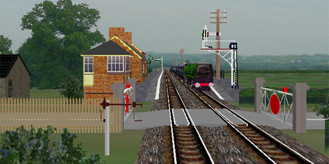
4.3.3 Great Britain
Barrow-Sellafield
Description:
A part of the Cumbrian Coast line, from Barrow-in-Furness to Sellafield in Cumbria, England. Northern Rail ran passenger traffic at this line with the class 156
DMUs when this simulation was made (today the route is run by Arriva). Beautiful stations and trackside details. Soft curves and realistic switches. The rural landscape is however rather empty of details.
Alt.:
2C47
Stations:
13
Stops:
10
Known problems:
Line description:
About the Cumbrian Coast line at
Wikipedia.
To download from this website:
N/A
Last update of this directory entry:
2018-Jun-17
Birmingham Cross-City South
Description:
The south portion of the Cross-City Line in Birmingham. It goes from Redditch to Birmingham New Street. Anthony Bowden has with this route created probably the most well done route there is for Open
BVE. Outstanding richness in details both in landscape and trackside. There are 17 different alternatives to drive this route different time of day, in different weather and different seasons.
Known problems:
To download from this website:
N/A
Last update of this directory entry:
2018-May-23
Moorgate - Drayton Park
Description:
The line Drayton Park - Moorgate in London (
BR), for the class 313 train. Most of the line is below surface in former subway tunnels. The train is actually using
3rd rail (750
V) as a subway train in these tunnels, but normal overhead wire (25
kV) at the part of the line above surface.
Alt.:
MG-DP
Stations:
5
Stops:
4
Known problems:
Line description:
Download from:
The route was distributed at Damon Cox' website, which has disappeared from the Internet >10 years ago.
Last update of this directory entry:
2018-May-26
Somerset & Dorset
Description:
A part of the old Somerset & Dorset Joint Railway in southern England. This local train is hauled by a steam engine and goes from Shillingstone to Templecombe (south of Bristol). The correct engine for this train is a Bullied Pacific class West Country steam engine, but in lack of such an engine a class J36 steam engine is used. The railroad, stations and the beautiful landscape is well done. The simulation intends to replicate the route as it looked like in the 1960s. The traffic at this and some other lines ended March 7 1966 after have being trafficked since August 31 1863.
Alt.:
Local
Stations:
5
Stops:
4
Known problems:
At the station Henstridge there is a goods wagon left at the main track. It blocks the way for the train driven in the simulation.
This can be corrected by deleting the following line in the route file Somerset & Dorset.csv
:
14108,.freeobj 0;82;0;0;180,
Misc.:
It is not possible to adhere to the time table in this simulation:
The maximum speed of the route is, according to the timetable, 25 mph.
The time table is based on use of the Bullied Pacific class West Country steam engine. At the simulated route, passenger trains were hauled by that engine class in speeds up to 90 km/h.
To download from this website:
N/A
Last update of this directory entry:
2018-May-23
Tyne Valley
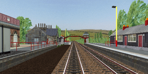
Description:
Newcastle and Carlisle Railway,
a.k.a. Tyne Valley Line, from Carlisle to Newcastle upon Tyne. Beautiful detailed landscape and many details trackside. There are no less than 13 alternatives to run all or part of the route, with different train classes.
Alt.:
MF 0713 [156]
Stations:
16
Stops:
15
Alt.:
MF 0742 [156]
Stations:
20
Stops:
10
Alt.:
MF 0933 [156]
Stations:
16
Stops:
4
Alt.:
MF 1127 [156]
Stations:
3
Stops:
2
Alt.:
MF 1134 [156]
Stations:
16
Stops:
5
Alt.:
MF 1230 [156]
Stations:
16
Stops:
8
Alt.:
MF 1444 [156]
Stations:
20
Stops:
10
Alt.:
MF 1530 [156]
Stations:
26
Stops:
6
Alt.:
Sa 0712 [220]
Stations:
16
Stops:
1
Alt.:
Sa 1117 [HST]
Stations:
16
Stops:
1
Alt.:
Sa 1316 [37]
Stations:
16
Stops:
1
Alt.:
Sa 1316 [47]
Stations:
16
Stops:
1
Alt.:
Su 1045 [156]
Stations:
11
Stops:
4
Known problems:
This route uses
3rd party object to simulate British light and semaphore signals. These objects were created by Simon Gathercole and Anthony Bowden.
The website on which this objects packages were distributed has disappeared from the Internet longa ago.
However there are archive files with these to download below from this website.
The unpacked directories BrSema4Sigs
and BrSigs
should be placed in the directory LegacyContent\Railway\Object
.
Download from:
The creator's website has disappeared from the Internet.
Last update of this directory entry:
2018-May-28
4.3.4 Fictitious places
Bay Park
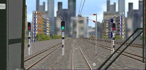
Description:
A Fictitious railroad in British environment. Select from a non-stop alternative, an alternative with a few stops (but rail works causing delays), and 2 local alternatives with stop at all stations. This electrified line starts in a small town and goes through the countryside to a big city. Many well-made details along the line and many landscape details!
Alt.:
Line works
Stations:
12
Stops:
4
Alt.:
Non-stop
Stations:
12
Stops:
1
Alt.:
Local 1
Stations:
12
Stops:
11
Alt.:
Local 2
Stations:
12
Stops:
11
Known problems:
Line description:
To download from this website:
N/A
Last update of this directory entry:
2018-May-24
Clarendon
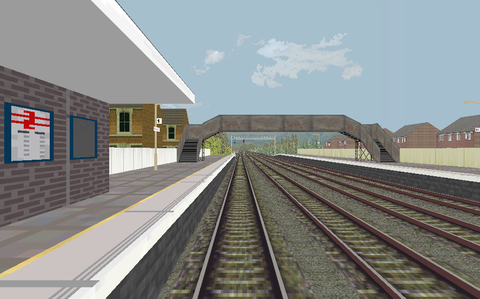
Description:
Clarendon is a fictitious line in British environment. There are both passenger trains and freight trains alternatives for this route. There are also night alternatives in compact darkness. Detailed route when it comes to trackside details and realistic signaling. Soft curves and some details in the mostly rural landscape.
Alt.:
Cl. 156
Stations:
8
Stops:
5
Alt.:
Cl. 158
Stations:
8
Stops:
7
Alt.:
Cl. 170 night
Stations:
8
Stops:
7
Alt.:
Coal
cl. 37
Stations:
5
Stops:
1
Alt.:
Coal
cl. 66
Stations:
5
Stops:
1
Alt.:
Cl. 37
Stations:
8
Stops:
1
Alt.:
Cl. 37 weed night
Stations:
8
Stops:
1
Alt.:
Cl. 66 weed night
Stations:
8
Stops:
1
Known problems:
In the 2 coal freight alternatives, a ghost train immediately appears at the same track as the train to be driven. Let the ghost train disappear in the distance, and you can the run the route normally.
Line description:
To download from this website:
N/A
Last update of this directory entry:
2018-Jun-21
Desert Freight
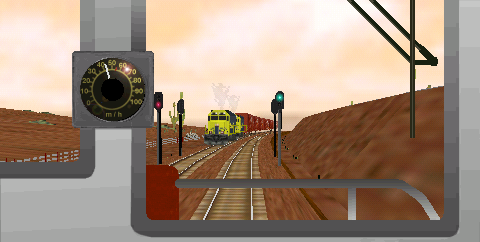
Description:
A fictitious railroad in American desert environment. Select from 5 alternatives: Two alternatives are freight trains, something rather unusual in Open
BVE, of which one daytime and one night alternative, both for train hauled by the diesel/electric engine class GP-38; Another 2 alternatives are passenger trains hauled by the class GS-4 steam engine, of which one is an express train and one a local train; Finally also a night time mail train hauled by the class GS-4 steam engine. Correct signal aspects, many graphic objects trackside and in the landscapes.
Creator:
Steve Green
Robert Raymond
Alt.:
Daytime freight
Stations:
6
Stops:
3
Alt.:
Night freight
Stations:
6
Stops:
5
Alt.:
GS-4 Express
Stations:
6
Stops:
1
Alt.:
GS-4 Local
Stations:
6
Stops:
5
Alt.:
Mail
Stations:
6
Stops:
1
Known problems:
Line description:
Download from:
This route was distributed at the website Train Sim Central
. That website has disappeared from the Internet long, long ago.
Last update of this directory entry:
2018-May-26
Heavy Coal
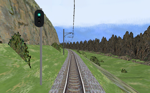
Description:
This is something rather unusual in Open
BVE: A freight route. The line is fictitious but the scene is an Australian line through mountainous terrain. The task is to drive 3 000 metric tons freight train with 30 coal-filled hopper cars from the COALEX terminal in Lithgow to its destination in Penrith. The route goes through the Blue Mountains, so there is the problem of pulling the freight uphill and then not to let the train overspeed downhill later on. This
BVE simulation is from the year of 2001, but it is still a good freight route.
Alt.:
To Penrith
Stations:
11
Stops:
1
Known problems:
Line description:
See the creator's file HeavyCoal.doc
located in the route's directory. It contains a description of the scenario, and driving instructions as well.
Download from:
This route and train were posted to the Internet 17 years ago, and the website for the route has disappeared at least 10 years ago.
Last update of this directory entry:
2018-Jun-17
Sakahara - Takahara line
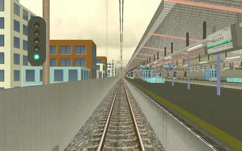
Description:
A fictitious railway line in Japanese environment. There are 4 alternatives for this line at different times of the day. Rather detailed route. The color scheme is however somewhat odd.
Alt.:
05:32
Stations:
5
Stops:
3
Alt.:
07:32
Stations:
5
Stops:
3
Alt.:
12:10
Stations:
5
Stops:
3
Alt.:
17:32
Stations:
5
Stops:
3
Known problems:
Line description:
Download from:
The creator's website (text in Japanese). Download the route file archive and the two object archives. The train for this route is also available at that webpage.
To download from this website:
N/A
Last update of this directory entry:
2018-Jun-20
Seaside
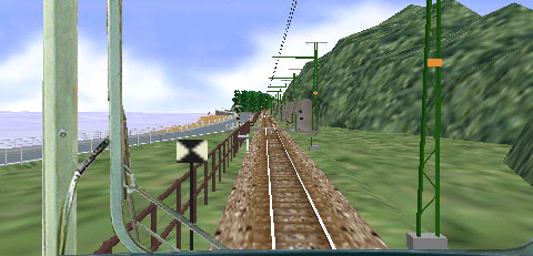
Description:
A short fictitious coastal railroad in Japanese environment. The line goes form Southern
Tsu to a place with a strange name with some similarity to the word flax. This route uses the class 115 train. Nice landscape details.
Alt.:
Towards Flax
Stations:
2
Stops:
1
Known problems:
Line description:
Download from:
The creator's website is gone from the Internet.
Last update of this directory entry:
2018-May-27
4.5 Streetcar lines
4.5.1 Japan
Minomachi line
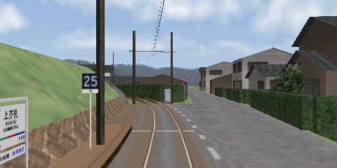
Description:
The
Minomachi line (
Nagoya Railroad
Co,
Ltd. a.k.a. Meitetsu) was a streetcar line from
Seki to
Tetsumeicho. The line, which was closed by 2005-Apr-01, was a single track line with the gauge 1067
mm and was electrified (600
V DC). These simulated routes for Open
BVE goes from
Shin-Seki to
Shin-Gifu and is used with the class 600, 880 or class 800 streetcars. The routes also uses the
Tagami line and a small portion of the
Kakamigahara line, the later which is electrified with 1 500
V DC. For that reason the streetcars used were equipped to also run on that voltage. This is a well-made route with a lot of details trackside and in the urban environment where this line located.
Alt.:
Express (600)
Stations:
17
Stops:
8
Alt.:
Local (800)
Stations:
17
Stops:
16
Alt.:
Local (880)
Stations:
17
Stops:
16
Known problems:
Between the stops in Kitaishiki and Ichinotsubo the graphic objects for the rails are misaligned at a couple of locations. Also there is a car parked to close to the track.
Download from:
The creator's website has disappeared from the internet a couple of years ago.
To download from this website:
OpenBVE route package ver. 1.0.0.0The code of this route has been adapted to load without errors and warnings in Open
BVE. The graphical experience is however not changed from Kaede Shiisugi's original work.
Last update of this directory entry:
2020-Mar-07
Tanigumi line
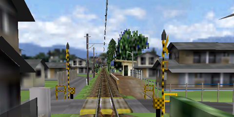
Description:
Tanigumi line (
Nagoya Railroad
Co,
Ltd. a.k.a. Meitetsu) is a streetcar line from
Kurono to
Tanigumi, for the class 750 streetcars (these streetcars were manufactured in 1928). It is a gauge 1067
mm single track line and is electrified (600
V DC). The line was closed at September 30 the year of 2001. A very well made route with many nice graphic objects and landscape details! Notice for example the sunlight in the forest openings.
Gaku has with this route confirmed his position as one of the best route makers for
BVE.
Alt.:
Daytime
Stations:
9
Stops:
8
Known problems:
None.
Download from:
The creator's website has disappeared from the Internet many years ago.
To download from this website:
OpenBVE route package ver. 1.0.0.1
The code of this route has been adapted to load without errors and warnings in Open
BVE. The graphical experience is however not changed from Gaku's original work.
Last update of this directory entry:
2023-Jun-25
4.5.2 Italy
Biella Oropa
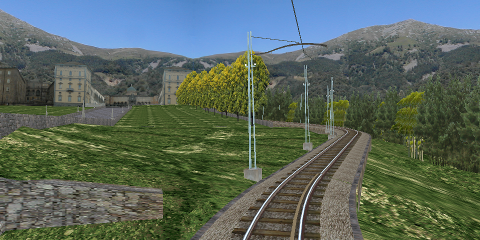
Description:
Part of the
Biella Oropa line that was between this city
Biella and the on a height located shrine
Santuario di Oropa. The gauge was 950
mm. The tramline was opened for traffic in 1911 and closed in 1958. This simulation is of the last few kilometers closest to
Santuario di Oropa, from the stop
Oropa Bagni to
Santuario di Oropa
Alt.:
Oropa
Stations:
2
Stops:
1
Known problems:
The route loads with one error in Open
BVE. The error is that the daytime timetable is not properly named.
This can be corrected by renaming the file Oropa-open.bmp
to Oropa-x.bmp
. It is in the folder of the route file.
Line description:
To download from this website:
N/A
Last update of this directory entry:
2020-Mar-07
4.5.3 Fictitious places
Linie 10 & Linie 11
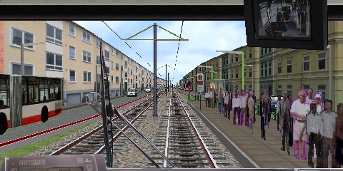
Description:
Linie 10 &
Linie 11 are two fictitious streetcar lines in German environment, using many graphic details of high quality. Also soft curves and realistic switches.
Linie 10 goes from
Lindhofenstaße to the streetcar depot beyond
Hostpitalstraße. There are 6 different alternatives for this line with different types of streetcars and different weather.
Linie 11 goes from
Lindhofenstraße to
Lesum. At that line there are track works with temporary speed restrictions, single track use and workers at the track. There are 4 alternatives for this route, including one driving a works car to move snow along the line.
Creator:
Hans-Martin Finken
Alt.:
Line 10 GT6
Stations:
14
Stops:
14
Alt.:
Line 10 T3D
Stations:
14
Stops:
14
Alt.:
Line 10 T3D-M snow
Stations:
14
Stops:
14
Alt.:
Line 10 T3D-M
Stations:
14
Stops:
14
Alt.:
Line 10 TW6000
Stations:
14
Stops:
14
Alt.:
Line 10 TW6000 snow
Stations:
14
Stops:
14
Alt.:
Line 11 G4-61
Stations:
15
Stops:
14
Alt.:
Line 11 G4-61 snow
Stations:
15
Stops:
14
Alt.:
Line 11 snow plough
Stations:
15
Stops:
1
Alt.:
Line 11 TW6000
Stations:
15
Stops:
14
Known problems:
Line description:
Download from:
The creator's website has long ago disappeared from the Internet. The route available at this website is the original version for
BVE 4, with transparency issues in Open
BVE corrected.
Another version of this route, based on the BVE 2 version of the route, is available at the website BVE Cornwall. It has fewer alternatives of streetcars to use.
Last update of this directory entry:
2018-May-26
This is search 417379 in the line directory


© Patrick Norqvist
e-mail
Last changed: 2023-Jun-24

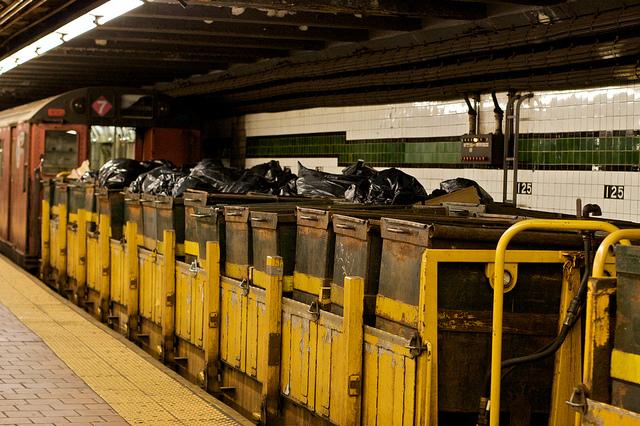